
 Annotation practice
Point cloud annotation and LiDAR annotation for autonomous and defense AI
Point cloud annotation and LiDAR services for autonomous and defense AI: 3D labeling, why it is harder than 2D, and why a wrong label needs an audit trail.

Anil Poonia
· 8 min read
- Annotation practice
- LiDAR
- Annotation
- Audit
Contents
Executive summary
Point cloud annotation, also called LiDAR annotation, is the labeling of 3D point clouds captured by laser sensors so perception models can learn to detect objects, surfaces, and terrain. Because it feeds safety-critical systems such as autonomous vehicles, drones, and defense, every label needs both a measured accuracy figure and a record of who produced it, under which guideline, and how it was checked.
Point cloud annotation: the key facts
- Point cloud annotation labels 3D data; geospatial annotation applies the same discipline to aerial, satellite, and mapping data, tied to real coordinates.
- The four main task types are 3D bounding boxes (cuboids), semantic segmentation, sensor fusion across camera, LiDAR, and radar, and temporal consistency across frames.
- Quality is measured by inter-annotator agreement scored in 3D, reported per class, not as a single average.
- The KITTI benchmark uses a 70 percent overlap threshold for cars and 50 percent for pedestrians and cyclists.
- The nuScenes dataset alone holds about 1.4 million 3D bounding boxes across 1,000 driving scenes; production programs run far larger.
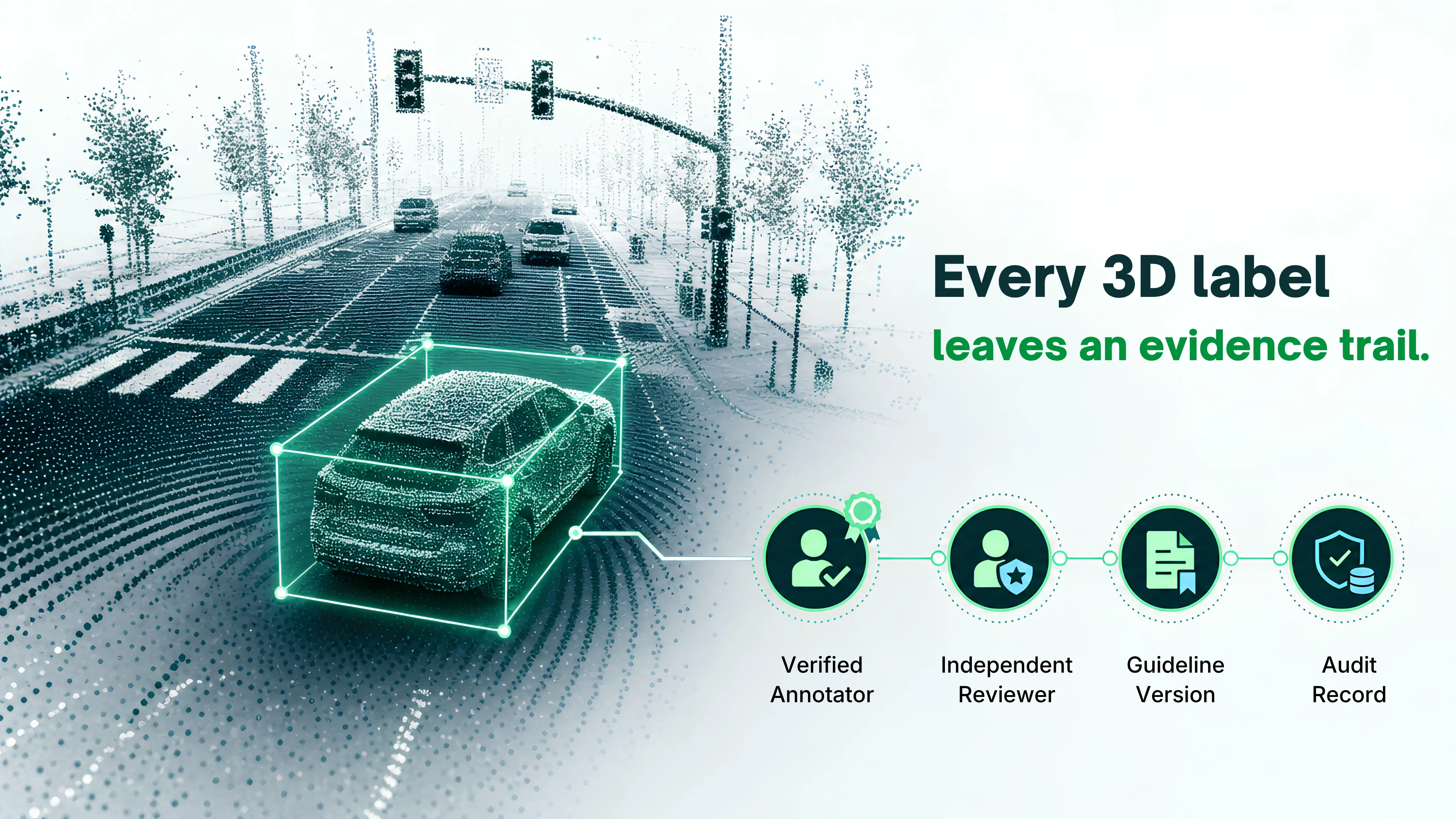
- In safety-critical AI, the audit trail (who labeled, which guideline version, who reviewed) is the deliverable, and it can only be captured while the labeling happens.
What makes LiDAR annotation harder than 2D image labeling?
A 2D image gives an annotator a dense grid of pixels and a familiar way of seeing. A LiDAR sweep gives them a sparse cloud of points in three dimensions, with density that falls off with distance and objects that are only ever partially visible from the sensor’s side. Drawing a box around a car in a photo takes a few seconds. Drawing a 3D box around the same car in a point cloud means estimating its far edge from a handful of returns, fixing its heading, and holding that estimate steady across the frames before and after.
Geospatial annotation has its own version of this. Aerial LiDAR and satellite imagery cover huge areas at low resolution per object, and the labels have to be tied to real coordinates, not just to pixel positions. A road centerline or a building footprint that drifts by a few meters is a mapping error, and downstream systems inherit it.
The practical effect is that lidar labeling is slower, more skill dependent, and more prone to honest disagreement between competent annotators than most 2D work. That last point matters more than the first two, and it is where most vendor pitches go quiet.
What are the main types of 3D point cloud annotation?
Most point cloud annotation services for autonomous vehicles, drones, and defense use a mix of four task types. Each one has a different quality metric and a different failure mode.
| Annotation type | What the annotator produces | Where it breaks |
|---|---|---|
| 3D bounding boxes (cuboids) | A box with position, size, and heading around each object in the point cloud. | Heading errors at range, boxes that swallow neighboring objects, inconsistent size for the same object across frames. |
| Semantic segmentation of point clouds | A class label for every point: road, sidewalk, vegetation, vehicle, pedestrian, building. | Boundary points between classes, sparse regions, class definitions that annotators read differently. |
| Sensor fusion (camera, LiDAR, and radar) | Labels that are consistent across modalities, so a box in the point cloud matches the same object in the camera frame. | Calibration drift, timing offsets between sensors, objects visible in one modality but not another. |
| Temporal consistency across frames | Stable object identities and tracks through a sequence, so the same vehicle keeps the same ID and a plausible trajectory. | ID swaps when objects cross, boxes that jitter frame to frame, tracks that vanish during occlusion. |
Geospatial annotation adds polygon and polyline work on georeferenced data: building footprints, road networks, land cover classes, change detection between two captures of the same area. The tooling looks different from an AV workflow, but the quality questions are identical. Was the guideline precise enough to get two annotators to the same answer, and can you show that they got there?
Scale is the other constant. The nuScenes dataset alone holds about 1.4 million 3D bounding boxes across 1,000 driving scenes. Production programs run far larger than that. At that volume, quality cannot be a spot check at the end. It has to be measured as the lidar labeling happens.
Why does safety-critical AI change the bar for lidar labeling?
In most machine learning, a labeling error moves a metric. In an autonomous vehicle, a drone, or a defense system, a labeling error moves the physical world. The perception model learns what the annotators taught it, and it carries their blind spots into traffic.
The clearest public record of this is the 2018 Uber test vehicle crash in Tempe, Arizona. The NTSB investigation found that the system never settled on a classification for the pedestrian pushing a bicycle, switching between vehicle, bicycle, and unknown object, and reset its trajectory prediction each time. Whether the root cause sat in the training data or in the software logic is a longer argument, but the lesson for LiDAR annotation is direct: an object class that annotators handled inconsistently is an object class the model will handle inconsistently at speed.
Regulators have noticed. In the United States, NHTSA’s Standing General Order, first issued in June 2021, requires companies operating automated driving systems to report crashes within set timeframes. In the EU, vehicle safety systems fall under the AI Act’s high-risk regime through the product safety route, with obligations that include documented data governance for training data. Defense programs add their own controls on chain of custody, data residency, and personnel access before a dataset can be used at all.
The common thread is that ground-truth quality in this vertical is not a nice to have. It is the thing an investigator, a certifier, or a program office will eventually ask you to prove.
What does defensible 3D point cloud annotation look like?
Accurate and defensible are two different properties, and a LiDAR annotation program needs both. Accuracy is about the labels. Defensibility is about the record around them. You can see how we structure this on our point cloud annotation services page.
Measure agreement, on the actual 3D task
Inter-annotator agreement on 2D boxes is a solved measurement. On 3D cuboids it needs care, because two competent annotators can disagree on a far edge or a heading without either being wrong. The working approach is to score overlap in three dimensions, set acceptance thresholds by class, and report the distribution rather than a single average. The KITTI benchmark, for reference, uses a 70 percent overlap threshold for cars and 50 percent for pedestrians and cyclists, which is a reasonable starting point for what “agreement” should mean per class. For semantic segmentation, agreement is measured per point and reported per class, because vegetation and vehicle will never score the same.
Ask any LiDAR annotation services vendor for their agreement figures on your task type and your classes. A vendor who measures it will answer in a sentence. A vendor who asserts quality will send a brochure.
Keep the audit trail from day one
When a system is investigated after an incident, the questions are specific. Which guideline version was in force when this frame was labeled? Who labeled it, what was their qualification, and who reviewed it? Was the box changed after review, by whom, and why? Was the sensor calibration recorded for the sweep?
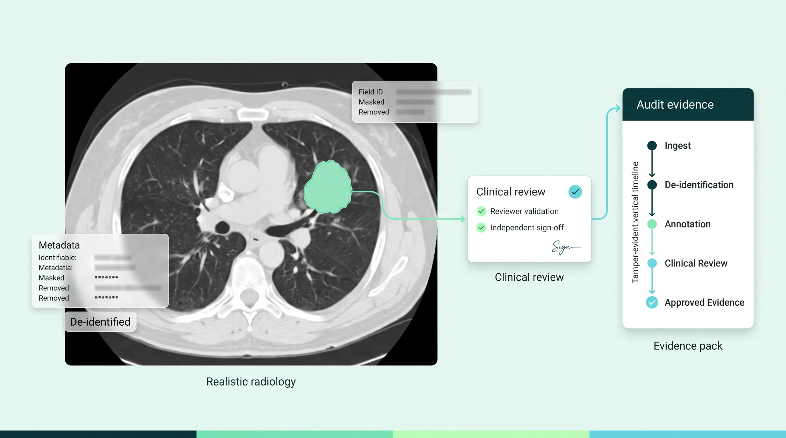
None of that can be rebuilt afterward. If the annotation platform did not log it while the geospatial annotation or lidar labeling was happening, the record does not exist. LabelFort, the data annotation platform from Predusk AI, logs every label change, reviewer decision, and guideline version against the frame it belongs to, so the export carries its own provenance. The same principle runs through our work on medical image annotation: in a regulated or safety-critical vertical, the evidence record is the deliverable, not a side effect of it.
Use domain reviewers, not a general crowd
Sensor data is unforgiving of untrained eyes. A crowd annotator can learn to box a car in a photo in an afternoon. Reading a sparse point cloud at 80 meters, telling a cyclist from a pedestrian with a bag, spotting a calibration offset between camera and LiDAR, or classifying land cover in aerial data takes training and supervised practice. Programs that run 3D point cloud annotation through a general crowd usually find out in the agreement numbers first, and in the model’s edge cases second.
The better pattern is a dedicated team trained on sensor data, with reviewers who have worked on autonomous vehicle or geospatial projects before, working under one guideline that is versioned and enforced by the platform. How to evaluate that kind of provider is covered in our guide to choosing a data labeling outsourcing partner you can defend.
Where this is not the right fit. If you are building a research prototype on a public dataset and the failure mode is a lower benchmark score, a lighter LiDAR annotation setup will serve you fine and cost less. The full agreement measurement and audit trail described here earn their cost when a label can end up in an incident report, a type approval file, or a defense program review. If that is not your situation yet, do not pay for it yet.
Next step
Bring us one sequence and one guideline. Send a LiDAR or geospatial sample, your class list, and your current guideline. We will run a scoped proof of concept, return per-class agreement figures and a full audit log with the labels, and tell you plainly where the guideline needs tightening before scale.
FAQs
What is the difference between LiDAR annotation and geospatial annotation?+
LiDAR annotation labels 3D point clouds from laser sensors, most often on vehicles, drones, or robots. Geospatial annotation labels georeferenced data such as aerial LiDAR, satellite imagery, and maps, tying each label to real-world coordinates. Many programs use both, and the quality controls are the same.
How is quality measured in 3D point cloud annotation?+
Point cloud annotation services measure quality through inter-annotator agreement scored in three dimensions: overlap between cuboids for detection tasks, and per-point agreement for segmentation, both reported per class rather than as one average. The record of who labeled and reviewed each frame, under which guideline version, is the second half of the answer.
Why does lidar labeling need an audit trail?+
Because the systems it trains can cause physical harm, and after an incident the questions are about specific frames, specific annotators, and specific guideline versions. That record can only be captured while the labeling happens.
Can general crowd annotators handle LiDAR data?+
Rarely at production quality. Sparse point clouds, sensor fusion, and temporal tracking take trained annotators and reviewers with sensor data experience. Agreement figures usually show the gap before the model does.
Recommended for you
Annotation practice Product updates
 Annotation practice
This is the evidence LabelFort ships by default.
IAA scored per cohort, audit trails on every action, evidence exports mapped to EU AI Act Articles 10 & 12.
Certifications & readiness